|
  |
|
Page 2 |
Newsletter 115, Winter 2016 © Hampshire Mills
Group |
HMG Autumn Meeting 9 September 2016
AGM, General Meeting and talk by Stephen Gadd
Alison Stott
|
|
On the evening of Friday 9 September
HMG members gathered at Warnford Village Hall for
our Annual General Meeting. Our chairman, Andy
Fish, welcomed everyone and also welcomed Stephen
Gadd. The meeting commenced with Stephen’s talk and
was followed by the AGM and brief general meeting.

|
|
Navigating the Avon from Salisbury to
Christchurch
in the Medieval and Early Modern Periods
Stephen Gadd’s talk as reported by
Alison Stott
Images from Stephen Gadd
|
|
Stephen Gadd started
his talk by showing us a picture of a ballad,
written in 1665, all about linking Salisbury to the
sea. In the 1660s considerable efforts had been
made to improve the navigation, despite the problem
of Christchurch harbour being so shallow. However
for some reason – possibly the closure of the priory
in Christchurch or the war with France in the 1690s
– these efforts were not successful, and trade began
to decline.
Four hundred years
earlier, in the 12th century,
Christchurch had both a priory and a castle and at
this time the process of engineering the river
began, with mill construction and deepening of the
river which enabled larger craft to use it, stone
from Purbeck being brought for the construction of
both priory and castle. Vessels could go upstream
all the way to New Sarum, bringing the material used
for building the new cathedral. |

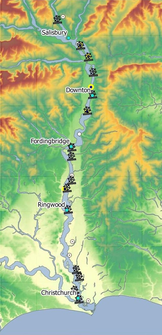
Mills on the River Avon
|
|

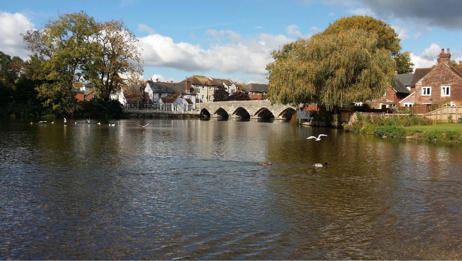
Fordingbridge today |
There had been a
bridge, or ford, at Fordingbridge since 1086 and by
1240 the river had four bridges along its length.
Stephen showed pictures of the strip maps published
in 1675 and used by travellers to find their way
from place to place – clearly showing the crossings
at Downton, Fordingbridge, and Ringwood. |
|
There is indirect evidence that the
river was navigable in the 14th century. In 1372
the government commissioned military barges. One of
these was built in Sarum, despite its not being a
port, the cost being borne by the townspeople; all
over England the same thing was happening. The
French attacked in 1377 and more and bigger barges
were ordered – these could obviously reach the sea
and Stephen thought that only about 6 inches of
water would have been needed for the unladen barges
to make the journey downstream.
In the 14th and 15th
centuries the presence of mills and fisheries
impeded passage, and caused a conflict of interest
with the river’s use as a navigation. Climate
change in the late 13th century from wet
to dry led to a famine in Northern Europe in the
early 14th century, but was also blamed
on the shortage of mills to process the grain; on
the other hand there were complaints of ‘certain
impediments which are called locks’! These
‘impediments’ could be destroyed by law as the river
was, and still is, the King’s (or Queen’s) highway.
For example the Priory Mill was destroyed in 1535 in
order to allow navigation.
Stephen illustrated
flash locks on the River Thames, and suggested that
the rush of water these caused helped to keep the
river running faster and deeper.
In 1660 twelve mills
are recorded on the Avon; however there was a
further problem with navigation as the narrow
entrance to Christchurch harbour was silting up.
|
|
 |
|
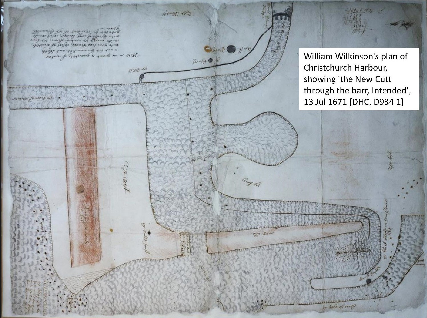
A cut that was proposed in 1670 was
begun in 1686; Mudeford Quay was built and
ironstone was used to make training piers. The new
cut made some difference as twenty six tons of coal
were recorded being shipped all the way to
Salisbury.
By 1854 further ironstone was being
mined from around Hengistbury Head, but
unfortunately this removed the protecting bank and
increased the rate of silting in the river mouth.
All the time Southampton was
competing for trade and Stephen thought that perhaps
restrictive practices there and the problems with
the silting up of Christchurch harbour eventually
led to the decline of navigation up the River Avon.
|
  |
|
|
