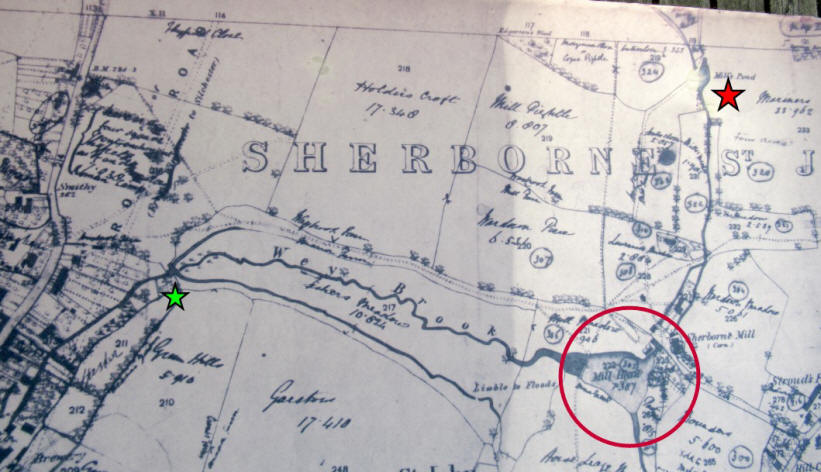
Mills and Millers of Hampshire volume 3 reports that
there were 3 mills in close proximity at Sherborne
St John on the Bow Brook. (Actually, the stream is
called Wey Brook, and joins Bow Brook at Beaurepaire
Mill further north.)
It specifically mentions Matthews Mill, “possibly on
the site now occupied by a water treatment works”,
and gives its location as SU 626 558. This location
seems implausible being only 100m west of Sherborne
Mill (circled in red). As can be seen from the map
below, the sewage works are 3-400m north of Sherborne Mill at SU 628 562. Looking at the older
map, the water works will be just below where the
‘ST’ is, but no mill is marked there.
However, there is a very small mill pond (compared
with that at Sherborne Mill) marked 200m further
north still, at SU 628 564 indicated by the red star
on both maps. At that site, the stream bed can be
seen to widen a bit and is filled with vegetation,
and there is a bridge over the stream, but no other
works are visible.
As for the third possible mill, there is no evidence
on the older map, except perhaps for what could be a
building on the stream to the west marked by the
green star.